Wednesday, March 31, 2010

Grand Canyon Trip - Carthage, MO to Home


March 31, 2010 - As Joel likes to say, "...Home again, home again, jiggety jig." We made it home tonight at about 8 p.m., after a stop in town at our favorite Mexican restaurant. (We knew there was no food in our house!) We came in the door, saying, "Look! It's our own couch! Our own bed! Our own toilet." Yes, you could say we're glad to be home.

We left Carthage, Missouri at about 9:30 this morning. Since I was behind the wheel today, there's no hour-by-hour narration (you lucky people), as Joel does not like to type at 65 miles per hour. As it turned out, thanks to the route we chose, we seldom reached 65 mph, anyway.

Not far out of Carthage, we reached roads that snaked across the hills of southern Missouri. I'd say we averaged somewhere around 40 mph for most of the 350 mile trip between Mt. Vernon, Missouri, and Doniphan, Missouri. The scenery was pretty, though.

It was good to reach the flat plains along the Mississippi River, where we could go faster, and even nicer to see the bridge over the river between Caruthersville, MO and Dyersburg, Tennessee.


And that muddy old river was a welcome sight, as well.


During our absence, the trees sprouted leaves, the grass turned green, and the fruit trees bloomed. Spring has sprung!

It was such a pleasant evening that, when we stopped for dinner, we opted for a table outside on the patio. As we ate, we recapped this trip - it was awesome! - and started planning our next one. We want to see New England, Niagra Falls, Mt. Rushmore, Yosemite.... Decisions, decisions.

We'll keep you posted! ;)

Tuesday, March 30, 2010

Grand Canyon: Tuesday - Garden City, KS to Carthage, MO


Tuesday, March 30, 2010 – Garden City, KS – Kansas stinks. Literally. At least this part of west Kansas stinks. That smell we detected yesterday in eastern Colorado lingers here, too. A man at a gas station in Granada, Colorado, said that the smell was coming from the farmland. I asked him if the farmers were spreading poo in the fields for fertilizer, and he said he believed so. I’m not so sure. We saw stockyards in Lamar, Colorado, where we first noticed the smell, and now, as we head out of Garden City and pass by another stockyard, that same, terrible, funky odor hangs in the air. This odor is worse than poo. It’s like rot, decay. It makes me want to think twice about eating store-bought beef!


We think we saw a prairie dog yesterday outside of La Junta, Colorado. He was in the roadway, and apparently unafraid of moving vehicles, for as we approached, he merely hunkered down in the road. He looked kind of like a small beaver, minus the teeth and tail, but he was a lighter shade of brown, almost gray. As we passed him, I asked Joel, “What was THAT?” He hadn’t seen it. Then, I noticed little dirt mounds all over the ground on both sides of the road. They had big holes in their centers, and –

EWWWW yeah, that smell is coming from stockyards. We just passed another one. Gah!


About 10:30 we reached Dodge City. Dodge City is where Wyatt Earp was the marshall during the 1870s. We saw a big sign that said “Boothill,” and we stopped to investigate. Beyond the sign was a souvenir shop and a Wild West Museum. We did not visit the museum, but we stopped in the gift shop, bought some loot for the grandchildren, and watched a film about the history of Dodge City. It turns out that “Boothill” is the name of a cemetery just up the hill from the museum, where people who were shot in gunfights were buried, often with their boots on, hence the name “Boothill.” After our visit to the gift shop, we drove around on the few blocks around the museum, where historic figures such as Wyatt Earp, Bat Masterson, and Doc Holiday were memorialized. Even the cast of Gunsmoke and some other famous movie/TV people were included. Thinking that the “memorials” would be statues, I wanted my picture made next to James Arness, a.k.a. “Matt Dillon.” However, the memorials turned out to be plaques embedded in the sidewalk – totally NOT fun for pictures – so we drove on back to Hwy. 400 and continued on our way home.
In Greensburg, KS, we saw signs for the World’s Largest Hand-Dug Well and the World’s Largest Meteorite. We were determined to have our picture made beside one or both of these objects. Alas, we did not see any other signs, and did not get to see these wonders. I am devastated. 


Joel had his picture made with a saloon hussy.


Graham, as we were coming through Kansas, with nothing to see on either side of the road except green grain fields and bIue sky, I tried to take a picture that would give you a sense of the open expanse. Every time I’d aim the camera at the horizon and press the shutter button, the camera would beep twice and flash a red X on the display screen. After several attempts, I finally dug the camera instruction manual out of the camera case to see what the problem was. The book said that two beeps and a red X means, “Don’t take that picture, dumbass…there ain’t nothin’ out there.” ;)

1:30 p.m. – Speaking of “nothing out there,” here’s one for the “WTF” Department: 25 miles outside Wichita, Kansas, in the middle of nowhere, we passed a road exit sign that said “40th Ave.” I thought it was a bit strange, but didn’t say anything. A few miles later, we passed another road exit sign that said “70th Ave.” Joel went, “Huh….” I said, “They must have big plans for this place.” He said, “What’s next? 100th Ave?” Well, guess what:


2:30 p.m. – A late lunch in Wichita. We opted for local flavor, rather than the same kind of fast food we could get anywhere. We decided on Kansas BBQ, but had no idea where to get it, so we just picked an exit and drove around looking for a building that said “BBQ” on the side. After 15 minutes of driving in circles with our stomachs rumbling, we finally stopped at a place called “La Galette,” even though we were pretty sure that there wouldn’t be any BBQ on the menu. Sure enough, it was “girl food” – crepes, quiche, cold cucumber soup, and such. On the bright side, they did have several cases full of things like crème puffs, tarts, and éclairs. I was about to order a chicken salad sandwich when Joel said to the lady behind the counter, “I really had my face set for barbeque.” Bless her heart, she sent us right down the street to a place called “Delano BBQ.” (We bought a crème puff “to go” from her, and not just to be nice, either, and when we got to Delano’s, we told them, “La Galette sent us down here, so when you see them, show them some love!”) They had both PIG and COW on the menu. Since we can get pork BBQ any old day of the week, we decided to try their barbequed beef brisket, and we smothered it with hot-sweet sauce. You know, it wasn’t bad. Ok, it was downright good. It wouldn’t cure a serious craving for REAL barbeque, but it was very tasty. The owner was very nice, too, and when she found out we were from Memphis, she wanted us to try their “hawg sauce” to see how close it came to Memphis barbeque sauce. Close, very close. We left full and happy. As for the crème puff, we shared half of it – a bite for Joel, a bite for me – zooming down Hwy. 400 (seriously “to go”). We’ll take out the rest of it later, when we’re in need of a little something.


Outside of Wichita, boy, was it ever windy! Joel had trouble keeping the Tahoe in the road. It was so windy that even the little farm ponds were white-capping. We saw crows and hawks in the air, trying to fly, flap-flap-flapping their wings but getting nowhere. Joel said he thought it might be easier for those birds to hunt down-wind and walk back.


6 p. m. - Minor “SNAFU” at the Missouri state line. The map program said one thing, the road signs said another. We followed the road signs, and, after a couple of miles, realized that we’d screwed up. Nothing’s coming, so Joel makes a U-turn in the middle of the highway, and we went back to the intersection where we took the wrong turn. It took a few miles (and a few more road signs) before we were sure we were back on the right track. Carthage, Missouri is 15 miles away.
On the road to Carthage, a black cat crossed our path, and right beside a cemetery! Joel did a pretend “spit” and made an “X.” We’ve been needing to do that, anyway, according to my former co-worker Mary Jo, the most superstitious person I’ve ever known. Mary Jo would have turned around and found another route to Carthage rather than cross the path of that black cat. And she would never, ever have chosen a different route home from the Grand Canyon than the one she took to the Grand Canyon. I once asked her what she would do if a black cat crossed her path just as she turned into her driveway. She answered, “Some things can’t be helped, and you just have to spit and make an ‘X’ and go on.” I just hope that one spit and one “X” covers both the black cat and the different route home.

The landscape here is beginning to look like home, with lots of budding trees, yellow Forsythia bushes and buttercups in the yards. It’s also nice to be in a place where people don’t think we have accents. ;)

In Carthage, we snagged a room at the "Precious Moments Hotel."


Yeah, THOSE "Precious Moments."


When we pulled into the driveway, Joel said, "It's pink!" Well, geez, what would you expect? ;)


Graham, just for you, some random pics, taken in Kansas and Missouri:


Monday, March 29, 2010

Monday, March 29, 2010 – Cortez, Colorado – Ahhhhhhhh, sleep. The motel bed and pillows were the comfiest we’ve found since we left our own bed, or perhaps it was just that the air here actually has oxygen in it, but we had the best sleep since leaving home. We availed ourselves of the free “continental breakfast” at the motel. Tim, I see what you mean about the sausage and gravy out here. When Joel and I took our first bites of biscuits/gravy, we both said, “YUCK!” Joel traded his biscuits/gravy in for a bowl of cold cereal. I nuked mine in the microwave, thinking that it would be better if it were hotter. I was wrong.

After leaving the hotel, we went to all of the local auto parts stores looking for a part to repair our blinker lights. None of them had one, but we finally found a Chevrolet dealership that hooked us up with the part. Joel replaced it in the parking lot, and said, “Okay, try it now.” I turned the key, flipped the blinker switch, and…it still malfunctioned.


Muttering swear words, Joel went back into the dealership’s service department and asked them to have a look at it. We were both dreading the diagnosis. Last year, a mouse had gotten inside the Tahoe while we weren’t using it, and we were both afraid that he had partially chewed a wire in two, and that it had finished breaking on the trip. But within just a few minutes, the mechanic came out, handed Joel the keys, and said we were set to go. We asked what problem they had found. “It was a bad bulb,” he said. “But we replaced all three bulbs with new ones!” we protested. He said one of the bulbs had a defect – a blob of glass where there it should have been smooth. Geez. Who’d-a thunk it? The mechanic said he left in the new board that Joel had bought, as the old one did look a bit burned. After about 30 minutes, we were on our way again.

Just outside town, we passed a barbeque restaurant that featured an enormous statue of a bull in the parking lot. For those of you who haven’t caught onto the problem yet, barbeque is PIG, not COW. ;)

Around noon, we were in Pagosa Springs, Colorado, where we stopped at a little soda fountain for lunch. We had been seeing tall, snow-capped mountains for a while.


Now, we were very near them. Before an hour had gone by, we were IN those mountains, driving through a mountain pass that looks treacherous, even in good road conditions. The curves were so tight you could almost see the back end of your car before you rounded them!


Just over the pass, the land was flat, surrounded by tall snowy mountains. It seemed to take forever to drive through that “bowl,” and we knew we’d have to go through another “pass” to get out the other side. Fortunately, the mountains were not as steep and scary on the other side.


An hour or so later, we reached Walsenburg, Colorado. Ten minutes out from Walsenburg, the scenery changed in a snap, and we were back in what looked like desert – no more mountains, no more tall spruce trees, just brown ridges, dotted with junipers. La Junta, Colorado is now about 50 miles away, and I’d swear we could see clear to there from here. For a while, Joel was afraid that I had mis-navigated us, and that we were going down someone’s long driveway instead of Hwy. 10, as we met about 1 other vehicle every mile or two.

Hah! On the way to La Junta, as barren as any place could be, stood one lone juniper along the edge of the road. From a distance, I saw glittering among its limbs. When we neared it, we saw that the glittering was from Christmas ornaments. We looked around; there’s not a house in sight. Joel wondered who rode waaaaaayyyy out here just to decorate that tree for Christmas!

In La Junta, we stopped for a stretch. It was about 5 p.m., too early to stop for the night, so we kept driving, intending to spend the night somewhere near the Kansas state line. I offered to relieve Joel at the wheel, and he took me up on the offer.

There were two little Colorado towns not far from the Kansas line – Lamar and Granada. When we reached Lamar, there was a smell in the air that would gag a buzzard. Although there were motels in the town, we kept driving. No motel in Granada. No motel in Coolidge, Kansas. No motel, except for what looked like a roach motel, in Syracuse, KS. We kept driving.

8 p.m., and we’re tired and hungry. We keep driving. We top a hill and see city lights twinkling in the distance. Boy, what a distance - at least 15 miles away! But town after town had no motel. We kept driving. Going 65 miles per hour, on a dark, two-lane road, with no telling what kinds of animals waiting to spring onto our path would’ve been scary, even if I weren’t half night-blind....

Finally, about 10 p.m., we reached Garden City, Kansas. We pulled off the road and consulted our computer map program. It said there were motels in Garden City. We finally found one, checked in, and then grabbed something to eat from a nearby drive-thru window. We’ll probably have nightmares after eating greasy French fries at 10:30 p.m. and going to bed on full stomachs.

Tomorrow: Dodge City, Wichita, and a whole bunch of little towns in south Missouri – a little over 800 miles, according to the map. We probably won’t make it home tomorrow.

Sunday, March 28, 2010

Sunday - making our way home

Sunday, March 28, 2010 – We checked out of our cabin at the Bright Angel Lodge and before we ever left the park we discovered that one of the rear signal lamps on the Tahoe was not working. Though we changed out the bulbs, the blinker continued to malfunction. We think we need a whole new gizmo – whatever that thing is that the bulbs plug into. There’s not an auto parts place or a car dealership anywhere near here. We’ll just have to drive until we find one.

Outside the park, we pulled into the airport where the helicopter rides can be had. We signed up for a 50 minute ride over the canyon. There were 6 people (plus the pilot) aboard. I was TERRIFIED when the helicopter took off, but when we flew over the rim of the canyon, I was too amazed to be scared. This was one awesome ride. I’ll only post one picture, as the shots from inside the Canyon didn’t turn out any more amazing than those taken from the rim.


When the helicopter ride was over, we headed down Hwy. 64 E. to Cameron, where we’d been told there was a very cool Native American trading post. At one store, Joel bought an Indian flute, and I found a pretty silver and turquoise ring. We had lunch there – Navajo Tacos. We’d been advised (by Dick, our tour guide from Friday) to get the small one. We should’ve listened to him. They were huge!

We took Hwy. 89, then Hwy. 160 toward Tuba City. The highway runs through some Native American reservations – Navajo and Hopi. It is the most barren place I have ever seen. New Mexico has nothing on this place when it comes to looking like Mars.


We really, really wanted to take our pictures with one foot in one state and one in the other in the “Four Corners” area – Utah, Colorado, Arizona, and New Mexico. Unfortunately, the monument was closed for renovations, and we could not get the picture.

A few hundred yards down the road, we entered Colorado. Look at the sign - “…Colorful Colorado” – and then see the “colors” we saw for the next 30 miles or so.


Those Coloradans are such wise guys. ;)


We’re spending the night in Cortez, Colorado.

Saturday, March 27, 2010

Grand Canyon - Saturday evening

Greetings from the Bright Angel Lounge. We got beer, salsa, and chips on the table, four bars of signal on the internet monitor, and a guy named Terry Rickard hammering out beer-drinking songs on his guitar. Life is good.

After Joel finished with his mule ride, we had lunch, a little walk, then a short nap. When we woke up, we decided that once we get the helicopter ride out of the way, we're ready to go home. We spent a few minutes plotting an alternate route home, avoiding interstate highways. It showed us a route through Colorado, Kansas, and Missouri, crossing the river at Kennett, MO, and rolling on home down Hwy. 51 in west Tennessee. This route will probably take us four days instead of the 2.5 days it took to get here, but we don't care. We've got the time, we're tired of driving 80 mph. and seeing America zooming by too quickly to even get a picture, and we're secretly hoping to run across Matt Dillon in Dodge City. So, alternate route, here we come.

We'll keep you posted.

For anyone reading this blog who did NOT get a copy of the Mule Ride e-mail, give me a shout, and I'll forward it to you. Otherwise, hang on a couple of days, and I'll post the story with pictures.

Friday, March 26, 2010

Friday A.M. - Desert View Tour

Friday, March 26, 2010 – We started the morning with breakfast at the Bright Angel Lodge restaurant. A little before 9 a.m., we boarded a tour bus for a “Desert View” tour. It was snowing like crazy.


Our driver, Dick, was a hoot, but he was full of good information.


We drove around to the various lodges, picking up other tourists. There were only a few of us – about 12 – on the tour.

It was very cold! The wind was whipping. I took a warm hat, but Joel didn’t. Fortunately, my jacket had a warm hood, and I loaned Joel my hat.


Our tour had several stops along the way where we got out of the bus, took pictures, and listened to Dick talk about history, geology, and other topics about the canyon. It was so cold that, on some stops, Dick let us out of the bus to take pictures, then called us back inside the bus for the lecture.
On the first few stops, the snow was so heavy that it obscured the views of the canyon…


…but as the morning wore on, the snow let up, the sun came out, and we saw some terrific scenes.


Most of the lodge buildings in the park were designed by architect Mary Jane Coulter. She also designed this “Watch Tower,” and commissioned local artists to decorate it, inside and out, with local Native American art. (They are doing a little remodeling work at the tower.)


When the tour was over, we came back to the lodge and had a bowl of chili and a rest in the cabin. At about 5 p.m., we have another tour to do – a sunset tour.

Thursday, March 25, 2010

Thursday

Thursday, March 25, 2010 – Last night we had a fun dinner with Tim and Shirley at a restaurant called “Sadie’s,” which boasted “New Mexico cuisine.” (Thanks again for dinner, Tim! It was yummy.) Poor Joel and Shirley…between me and Tim running our mouths nonstop, they scarcely got in a word apiece.

Shirley and Tim were sweet to remember that this trip is our 30th wedding anniversary get-away, and they brought us a present – a soft, fleece blanket.
We brought them a present, too: sausage.

Yeah, sausage.

You see, Tim had offered to treat us to dinner on the condition that I’d make him some sausage gravy and biscuits when he comes to visit us. It seems he had sausage gravy in Tennessee once, and he thinks that our pigs and our sage must have special flavors that cannot be duplicated outside the state. Since heaven only knows when he will get to Tennessee, and since a body can go only so long without sausage gravy, we decided to help him through this awful, gravy-less phase. So, Tuesday morning before we left, we stopped by the grocery store and bought eight pounds of sausage - four for Tim, and four for Shirley. When we presented the packages to them after dinner, they looked at us like, “You brought us sausage?”

Heh. :)

I would’ve liked to have visited a little longer, but our early wake-up call, coupled with the two margaritas at dinner, made my eyelids awfully heavy. We said our ‘goodnights” about 9 p.m.

With my body still on Central Daylight Savings Time, I woke up at what the New Mexicans thought was 5:15 a.m. Joel slept a while longer. We dressed, ate breakfast at the hotel, and finally got on the road about 8:45. In six hours, if all goes well, we should arrive at the Grand Canyon. We’re taking I-40 from Albuquerque to Williams, Arizona. From there, it’s a straight shot north to the Canyon.

Just outside the Albuquerque city limits, one tops a hill, and, suddenly…Welcome to Mars! The landscape changes, and everything is brown and red. It’s kind of surreal and spooky, if you want to know the truth!


And these mesa things…boy, are they strange. It’s like the earth just sank all around them, leaving them high and dry on the landscape. And then there are the little humps/lumps – they probably don’t call the little ones “mesas” - set right out in the middle of nothing. I told Joel there’s probably an ancient king or chief buried under every one of them.

And there aren’t any trees out here. None. They have scrubby little cedars, but those don’t count as trees. I’m threatening to mail Tim some sweet gum balls and some acorns, to see if he can get some trees started out here, but I’m doubtful that they’d take root, as there is no dirt, only powdered rocks, and evidently no water. I don’t even see how the cedars are making it. Now we know why Native Americans lived in teepees and people built adobe houses out here: they didn’t have any wood! ;)

12:00 noon (somewhere): We crossed the Arizona state line at noon, according to Joel’s watch and the car clock. Joel asked, “Did we change time zones?” Like I knew. I flipped open his telephone, which always seems to know what time it is, regardless of where we are, and it said 10:01. Wooo-hooooo, two extra hours to get where we’re going! Now we can stop and do tourist things, if we want to, without screwing up our original schedule.

The landscape has changed again. No more of that red mesa business, and no more snowy mountains in the distance. There are hills, but they are not sharp and jagged like they were in New Mexico, and they are more brown than red. And they have trees. Not a lot of trees, mind you, but I am seeing deciduous things with trunks and limbs.

On second thought (re. not seeing any mountains /mesas in the distance), I remember seeing a few miles back a sign that said “Elevation 6000 ft.” Maybe we are just on TOP of the world, and there’s nothing taller to be seen.

And I take back that thing I said about trees. There aren’t even any cedars up here!


There are a few cows up here at the top of the world. If you’ve never noticed, when they’re not lying down to rest, cows spend most of their time with their heads bent down, eating. Not these cows. They’re just standing around, looking off in the distance. They’re watching for somebody to come with some hay, I reckon, because there’s sure not much else for them to eat up here.


We stopped at Geronimo to have a stretch and a look around. All that was there was a souvenir shop. As we left the parking lot and merged onto the interstate, we both gasped as a tumbleweed came out of nowhere and crashed into our car.
Our stomachs were growling as we neared Winslow, Arizona. “Do you want to stop at Winslow to eat?” Joel asked. I said it sounded like a good idea. We drove on. About two minutes later, we said, simultaneously, “Isn’t there a song with Winslow, Arizona in it?” The song was on the tips of our tongues, but neither of us could bring it to mind. When we stopped at the Country Market restaurant/buffet, I asked the waitress, “It’s driving us crazy…what’s the song with Winslow, Arizona in it?”
It was “Take It Easy,” by the Eagles. Yeah, we knew that!

As we left the restaurant, we found a piece of tumbleweed stuck in the grille of the Tahoe. :)

67 degrees
150 miles from here to the Canyon.

3:12 (Tahoe time) – we crossed the “Arizona Divide.” We’re not sure what it divides. We think it might be the “tree side” vs. the “no trees side,” as there are now billions of tall pine trees around us. There is also snow on the ground. 51 degrees.

3:00 (Arizona time) – We finally made it!


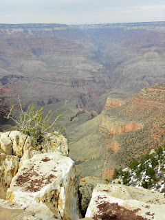
All the way through the park, the trees kept obstructing our view of the Canyon. When we got inside the lodge, we found we could not check in for another hour, and I asked the lady where we could go to see the Canyon. She said, “Step right outside the back door.” We did.

Wow.

WOW.


No other words do it justice.

We immediately did a tiny little hike. The view is … WOW.

Tomorrow, we’re doing some bus tours. Joel’s mule ride is Saturday morning. We’re taking a helicopter ride on Sunday. After that, the schedule is kind of up in the air.

Check you later!

Wednesday, March 24, 2010

Grand Canyon, Day Two, Part Two

Wednesday, March 24, 2010 – We hit the road from Yukon to Albuquerque at about 8 a.m., under low, gray clouds. We thought it was going to rain, and it did drizzle a little bit, and although the rain went away, the skies stayed gray. It was close to 60 degrees when we left Yukon, with me behind the wheel.

Joel has been manning the camera today. He’s discovered that it’s quite a feat to get a clear picture of a road sign from a vehicle moving 75 mph. I’ve heard a lot of snapping, but don’t know what shots he got. I’ll put them at the bottom of this entry, with a little narrative, if I can figure out what he was photographing.

We reached the Texas state line somewhere around 10 a.m. Here, the temperature registered about 48 degrees. I take back what I said about Arkansas being flat. I hadn’t seen flat until I saw the Texas panhandle. Buddy, it’s FLAT. Two hours across the state line, we reached Amarillo, where we stopped to fill up the gas tank and grab something to eat. By this time, it was 38 degrees. The travel center where we bought the gas had a McDonald’s inside, and also a Subway Sandwich Shop. We were trying to decide between the two eateries when I spied hot dogs in a roaster. We headed for the hot dog bar, grabbed a bag of chips to share, and bought cups of iced tea. While we were waiting in line to pay for our food, I looked around for a place to sit. There weren’t any seats in the place except for those inside the McDonald’s. I asked the cashier if we could sit in the McDonald’s. She pulled a doubtful look, but said we could try it, but they might kick us out. We opted to eat in the car!

In between bites of hot dog, I called Tim to tell him where we were and to give him an ETA for Albuquerque. He said it was snowing there, and that the weather conditions might delay us. Oh great. I wolfed down the rest of my hot dog, and got back onto the interstate.

Just west of Amarillo, it began to snow. I will admit to saying a few curse words when that mess started. But the snow was pellet-y, and it blew right off the highway. After a few miles of fairly cautious progress, I put the pedal to the metal. After about half an hour, the snow went away.

Thank goodness for a change of scenery in New Mexico. There wasn’t much action right near the interstate – nothing but cacti and cedars – but in the distance we could see lumps. I think these New Mexicans call them “mesas.” To me, this scenery is much more interesting than that of the Texas panhandle area, but I doubt the Texans would abide that kind of talk.

The speed limit in New Mexico is 75. I let ‘er rip.

In Cuervo, New Mexico, it started snowing again, but it blew right off the roadway.
Somewhere near Santa Rosa, we took a stretch break. The temperature was back up in the low 40s, but there was a monstrous wind blowing. Joel took over the driving from there, about 80 miles out of Albuquerque. While he drove, I checked the AAA Travel Guide for a motel in Albuquerque. While I was on the phone with the reservations clerk, we ran through a BLIZZARD. It lasted for about 3 miles and was over by the time I got off the telephone. We’ve run into tiny little snow storms about 10 times since then. It’s piling up along the edges of the interstate, but not sticking to the road, thank goodness.

We’ll be staying at a Hampton Inn right in the middle of Albuquerque, halfway between Tim’s house and Shirley’s house.

It's 4:07, and we’re 25 miles from Albuquerque. It’s 36 degrees.

Somewhere between Zuzak and Carnuel, the mountains crept up to the interstate. Damn, Tim’s mountains don’t have anything growing on them but rocks. ;)

2:52, or 4:52, or 3:52 – we’re in our hotel room. The hotel clock says 2:52, Joel’s watch says 4:52. I just called Shirley, and she says it’s 3:52. Tim, Shirley, Joel, and I are getting together for dinner at a restaurant called “Sadie’s” sometime later this evening. Tim says they serve “New Mexican” food. This ought to be interesting.

Here are some of today's pictures.

For you, Graham, more funny place names:


Personally, I feel it's a tad sacreligious (or at least plain old tacky) to name a travel center after Jesus.


Close to Amarillo, we saw these wind turbines whirling. I've seen their giant blades being hauled down the roads by 18-wheelers, but have never seen the actual windmills in action. They're kind of awesome to watch.


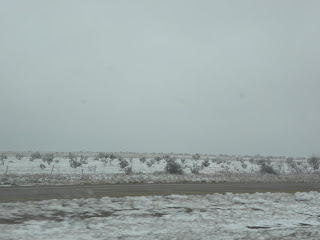
Snow, west of Amarillo.


Some New Mexico pictures:


Grand Canyon - Day Two, Part One

6:45 a.m. - We stayed at a Best Western Inn last night, and although the room was nice and clean, and the air conditioner was loud enough to drown out all other noises, I didn't fall asleep until way past midnight. Fifteen minutes ago, a strange thump woke me up (probably a door slamming), and I got up and took a shower. Afterwards, I made enough noise to wake Joel up, and now he's having his shower. We decided last night that we'd better hit the road a good bit earlier than we did yesterday if we want to get to Albuquerque by dinnertime.

Graham, we are getting on fabulously with the other road users. Joel is a very polite and safe driver. The interstate speed limit is 70, and just look what a law-abiding driver he is:


We are confident that we will arrive safely in Albuquerque. In hoc signo vinces.